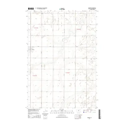
2015 Map of Warner
USGS Topo · Published 2015About this map
Warner anchors the western edge of this 2015 survey, situated in a landscape defined by the meandering path of Moccasin Creek. This portion of Brown County exhibits the systematic organization of the Public Land Survey System, with a dense grid of gravel and paved roads like 388th Ave and 142nd St carving the prairie into regular sections. The land remains primarily agricultural, though specialized footprints like the Thorson Airfield north of the town center indicate the local infrastructure supporting regional aviation. The winding channel of Moccasin Cr provides the primary topographic relief, cutting across the section lines and creating small pockets of riparian vegetation amidst the expansive fields of the James River Valley.
Find a feature on this map
23 named features on this map. Tap any name to fly to it.
Don’t see what you’re looking for? This feature index may not catch every label — zoom into the map to look around manually.
Map Details
Editions of this 2015 Warner Map
This is the sole edition of this map. No revisions or reprints were ever made.
Other maps of this area

1895 · Aberdeen
USGS Topo · 1:125,000

1899 · Northville
USGS Topo · 1:125,000

1953 · Brentford
USGS Topo · 1:24,000

1953 · Stratford
USGS Topo · 1:24,000

1953 · Warner
USGS Topo · 1:24,000

1954 · Bath
USGS Topo · 1:24,000

1954 · Mellette
USGS Topo · 1:24,000

1954 · Aberdeen
USGS Topo · 1:250,000

1956 · Aberdeen
USGS Topo · 1:250,000
1960 · Aberdeen East
USGS Topo · 1:24,000