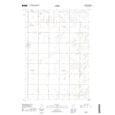
2017 Map of Warner
USGS Topo · Published 2017About this map
The town of Warner serves as the focal point for this section of Brown County, situated in a region defined by agricultural plots and the wandering path of Moccasin Creek. The landscape is organized by a strict cardinal grid of rural roads, including 388th Ave and 142nd St, which divide the township into sections. Evidence of local infrastructure is seen at Thorson Airfield in the northern portion of the map, providing a glimpse into the utility-driven development of the South Dakota plains. The hydrography is dominated by the seasonal and perennial flows of Moccasin Cr, which meanders through the eastern and central sections. This survey illustrates the modern layout of rural settlements and the primary thoroughfare of South Dakota St as they existed in the early 21st century.
Find a feature on this map
25 named features on this map. Tap any name to fly to it.
Don’t see what you’re looking for? This feature index may not catch every label — zoom into the map to look around manually.
Map Details
Editions of this 2017 Warner Map
This is the sole edition of this map. No revisions or reprints were ever made.
Other maps of this area

1895 · Aberdeen
USGS Topo · 1:125,000

1899 · Northville
USGS Topo · 1:125,000

1953 · Brentford
USGS Topo · 1:24,000

1953 · Stratford
USGS Topo · 1:24,000

1953 · Warner
USGS Topo · 1:24,000

1954 · Bath
USGS Topo · 1:24,000

1954 · Mellette
USGS Topo · 1:24,000

1954 · Aberdeen
USGS Topo · 1:250,000

1956 · Aberdeen
USGS Topo · 1:250,000
1960 · Aberdeen East
USGS Topo · 1:24,000