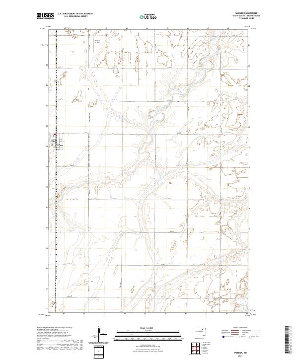
2021 Map of Warner
USGS Topo · Published 2021About this map
The town of Warner serves as the primary hub in this portion of Brown County, situated at the intersection of Co Rd 10 and South Dakota St. The landscape is defined by the winding course of Moccasin Creek, which meanders across the eastern and central sections of the survey. This drainage pattern, accompanied by numerous wetlands and small basins, reflects the glacial till plains characteristic of the region. Transportation follows a strict section-line grid, typical of the Great Plains, with routes like 389th Ave and 142nd St providing access to the surrounding agricultural land. North of the town, Thorson Airfield stands as a notable landmark among the fields, indicating the local reliance on aviation for agricultural or private transport in this expansive terrain.
Find a feature on this map
26 named features on this map. Tap any name to fly to it.
Don’t see what you’re looking for? This feature index may not catch every label — zoom into the map to look around manually.
Map Details
Editions of this 2021 Warner Map
This is the sole edition of this map. No revisions or reprints were ever made.
Other maps of this area

1895 · Aberdeen
USGS Topo · 1:125,000

1899 · Northville
USGS Topo · 1:125,000

1953 · Brentford
USGS Topo · 1:24,000

1953 · Stratford
USGS Topo · 1:24,000

1953 · Warner
USGS Topo · 1:24,000

1954 · Bath
USGS Topo · 1:24,000

1954 · Mellette
USGS Topo · 1:24,000

1954 · Aberdeen
USGS Topo · 1:250,000

1956 · Aberdeen
USGS Topo · 1:250,000
1960 · Aberdeen East
USGS Topo · 1:24,000