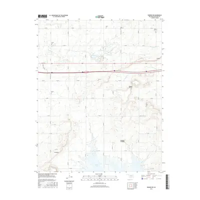
2016 Map of Warner NW
USGS Topo · Published 2016About this map
Eufaula Lake dominates the southern reaches of this landscape, its fingers reaching into the drainages of Mud Cr and Duchess Cr. The area around Duchess Landing and the rural community of Shady Grove reveals a complex network of county roads, such as E 1080 Rd and Soda Springs Rd, that connect scattered homesteads and family burial grounds. The prevalence of small cemeteries, including Vandier Cem, Paradise Cem, and Twin Grove Cem, provides a detailed record of local genealogy in this corner of Oklahoma. High ground is marked by Mt Nebo, while the eastern portion is defined by the winding course of Georges Fork. The map documents a landscape where modern infrastructure intersects with established rural settlements and traditional land-use patterns.
Find a feature on this map
31 named features on this map. Tap any name to fly to it.
Don’t see what you’re looking for? This feature index may not catch every label — zoom into the map to look around manually.
Map Details
Editions of this 2016 Warner NW Map
This is the sole edition of this map. No revisions or reprints were ever made.
Other maps of this area

1896 · Okmulgee
USGS Topo · 1:125,000

1900 · Sansbois
USGS Topo · 1:125,000

1900 · Canadian
USGS Topo · 1:125,000

1900 · Okmulgee
USGS Topo · 1:125,000

1901 · Muscogee
USGS Topo · 1:125,000

1905 · Muscogee
USGS Topo · 1:125,000

1909 · Sans Bois
USGS Topo · 1:125,000

1911 · Sansbois
USGS Topo · 1:125,000

1946 · Fort Smith
USGS Topo · 1:250,000

1948 · Keefeton
USGS Topo · 1:62,500