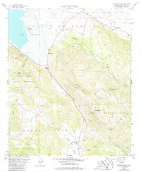
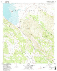
1960 Map of Warners Ranch
USGS Topo · Published 1988About this map
Warners Ranch and the historic Butterfield Stage Station anchor this high-country landscape in the San Diego back country. The terrain is defined by the broad San Jose Del Valle and the seasonal waters of Lake Henshaw, which sits below Monkey Hill. Large tracts of the Santa Ysabel Indian Reservation span the southern and western portions of the quadrangle, where the Santa Ysabel Volcan Mountains rise steeply. Historical land use is evident in the numerous ruins near Juan Flat and a mine tucked into the slopes above Matagual Valley. The road network is sparse, centering on Morettis Junction where 79 meets local routes, reflecting a landscape still dominated by cattle ranching and open range at the time of the 1960 field check.
Find a feature on this map
34 named features on this map. Tap any name to fly to it.
Don’t see what you’re looking for? This feature index may not catch every label — zoom into the map to look around manually.
Map Details
Editions of this 1960 Warners Ranch Map
5 editions found
Other maps of this area

1903 · Ramona
USGS Topo · 1:125,000

1904 · Southern California Sheet No. 2
USGS Topo · 1:250,000

1939 · Warner Springs
USGS Topo · 1:62,500

1939 · Santa Ysabel
USGS Topo · 1:62,500

1939 · Palomar Mountain
USGS Topo · 1:62,500

1942 · Ramona
USGS Topo · 1:62,500

1943 · Santa Ysabel
USGS Topo · 1:62,500

1943 · Warner Springs
USGS Topo · 1:62,500

1947 · Ramona
USGS Topo · 1:62,500

1947 · Santa Ana
USGS Topo · 1:250,000