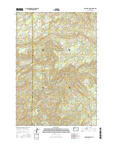
2017 Map of Warnicke Creek
USGS Topo · Published 2017About this map
The Siletz River and its complex drainage network define this high-elevation landscape along the boundary between Lincoln and Polk counties. The terrain is characterized by steep ridges and deep drainages, including the North Fork Siletz River and the South Fork Siletz River, which converge in the southern portion of the sheet. Notable peaks such as Stott Mtn and Sugarloaf Mtn overlook a labyrinth of watercourses including Warnicke Creek and Crowley Mine Cr. This 2017 survey reveals the modern forestry and conservation patterns of the Oregon Coast Range, where human infrastructure is limited to primitive access routes like Murphy Rd and Riley Peak Rd. The presence of labels like Crowley Mine Cr suggests the area's history of resource extraction, while the headwaters of the Salmon River in the north highlight the region's importance as a critical watershed.
Find a feature on this map
30 named features on this map. Tap any name to fly to it.
Don’t see what you’re looking for? This feature index may not catch every label — zoom into the map to look around manually.
Map Details
Editions of this 2017 Warnicke Creek Map
This is the sole edition of this map. No revisions or reprints were ever made.
Other maps of this area

1941 · Nestucca Bay
USGS Topo · 1:62,500

1942 · Euchre Mtn
USGS Topo · 1:62,500

1942 · Spirit Mtn
USGS Topo · 1:62,500

1942 · Nestucca Bay
USGS Topo · 1:62,500

1942 · Valsetz
USGS Topo · 1:62,500

1943 · Euchre Mtn
USGS Topo · 1:62,500

1948 · Vancouver
USGS Topo · 1:250,000

1950 · Vancouver
USGS Topo · 1:250,000

1950 · Vancouver
USGS Topo · 1:250,000

1953 · Salem
USGS Topo · 1:250,000