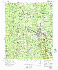
1978 Map of Warren
USGS Topo · Published 1978About this map
The Warren city center and its radiating rural communities define this Bradley County landscape in the late 1970s. As the regional hub, the city contains the courthouse and post office, surrounded by timberlands and agricultural creek bottoms. The Saline River and its associated wetlands, including Gin House Slough and Reeps Lake, form a significant natural boundary to the east. Transportation patterns reflect a period of transition, with the Missouri Pacific Railroad active alongside an Abandoned Railroad near McKinney. The map is particularly dense with rural religious and social landmarks, showing numerous country churches like Moseley Chapel and Wheeler Springs Ch, alongside several family cemeteries such as Parnell Cem and Carter Cem. Small settlements like Greenland and Farmville appear as clusters of homes and churches, illustrating the enduring decentralized settlement pattern of the Arkansas timber belt.
Find a feature on this map
99 named features on this map. Tap any name to fly to it.
Don’t see what you’re looking for? This feature index may not catch every label — zoom into the map to look around manually.
Map Details
Editions of this 1978 Warren Map
This is the sole edition of this map. No revisions or reprints were ever made.
Other maps of this area

1934 · Ingalls
USGS Topo · 1:48,000

1934 · Moro Bay
USGS Topo · 1:62,500

1935 · Feenyville
USGS Topo · 1:62,500

1937 · Ingalls
USGS Topo · 1:62,500

1938 · Moro Bay
USGS Topo · 1:62,500

1939 · Moro Bay
USGS Topo · 1:62,500

1939 · Ingalls
USGS Topo · 1:62,500

1953 · Greenwood
USGS Topo · 1:250,000

1953 · El Dorado
USGS Topo · 1:250,000

1956 · Greenwood
USGS Topo · 1:250,000