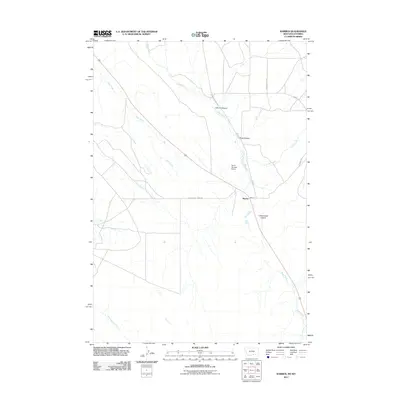
2011 Map of Warren
USGS Topo · Published 2011About this map
Warren sits as the central point of interest in this high-plains landscape near the Montana-Wyoming border. The settlement is positioned along the drainage of Sage Creek, which winds southeast toward the Cottonwood Coulee. This area is characterized by significant topographic relief, most notably at Inferno Canyon and King Canyon, where the drainage patterns have carved distinct pathways through the terrain. Evidence of infrastructure and local industry is visible through labels such as Drum Number 2 Dam and the network of specialized thoroughfares including Railroad Grade Rd and Quarry Rd. The hydrological system is well-defined by numerous waterways, including Jack Creek and Piney Creek, which drain the open country. This 2011 survey highlights the intersection of transportation and natural features, capturing the way land use follows the contours of the coulees and creek beds.
Find a feature on this map
13 named features on this map. Tap any name to fly to it.
Don’t see what you’re looking for? This feature index may not catch every label — zoom into the map to look around manually.
Map Details
Editions of this 2011 Warren Map
This is the sole edition of this map. No revisions or reprints were ever made.
Other maps of this area

1954 · Billings
USGS Topo · 1:250,000

1955 · Cody
USGS Topo · 1:250,000

1957 · Billings
USGS Topo · 1:250,000

1958 · Billings
USGS Topo · 1:250,000

1958 · Cody
USGS Topo · 1:250,000

1962 · Cody
USGS Topo · 1:250,000

1966 · Frannie
USGS Topo · 1:24,000

1966 · Elk Basin
USGS Topo · 1:24,000

1966 · Deaver Reservoir
USGS Topo · 1:24,000

1969 · Warren
USGS Topo · 1:24,000