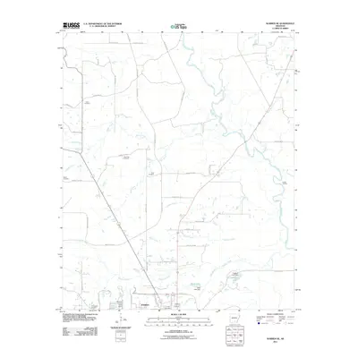
2011 Map of Warren NE
USGS Topo · Published 2011About this map
The Warren city limits extend into the southern reaches of this landscape, where the northern edges of the town meet a network of rural roads and creek drainages. The Saline River winds prominently through the eastern portion of the area, creating a complex of oxbows and swampy lowlands, including Rubes Landing. This river system is fed by numerous tributaries such as Walker Creek, Seay Creek, and Walnut Creek, which define the drainage patterns between the various county roads.
Find a feature on this map
55 named features on this map. Tap any name to fly to it.
Don’t see what you’re looking for? This feature index may not catch every label — zoom into the map to look around manually.
Map Details
Editions of this 2011 Warren NE Map
This is the sole edition of this map. No revisions or reprints were ever made.
Other maps of this area

1935 · Feenyville
USGS Topo · 1:62,500

1953 · Greenwood
USGS Topo · 1:250,000

1953 · El Dorado
USGS Topo · 1:250,000

1956 · Greenwood
USGS Topo · 1:250,000

1957 · El Dorado
USGS Topo · 1:250,000

1958 · El Dorado
USGS Topo · 1:250,000

1960 · El Dorado
USGS Topo · 1:250,000

1970 · New Edinburg
USGS Topo · 1:24,000

1970 · Herbine
USGS Topo · 1:24,000
1972 · Wilmar South
USGS Topo · 1:24,000