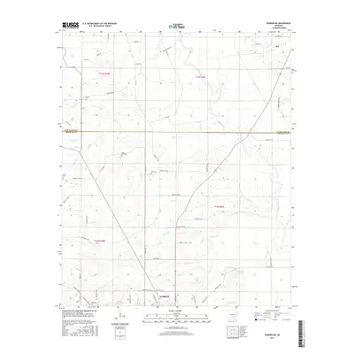
2017 Map of Warren NE
USGS Topo · Published 2017About this map
Warren serves as the southern anchor of this Bradley County landscape, where the town's northern outskirts give way to a network of creeks and timbered bottomlands. The terrain is defined by the winding course of the Saline River, which cuts through the northeastern corner, and its many tributaries including Walker Cr, Seay Cr, and Crane Cr. Smaller settlements and family centers are scattered throughout, most notably the community of Rye in the northeast.
Find a feature on this map
65 named features on this map. Tap any name to fly to it.
Don’t see what you’re looking for? This feature index may not catch every label — zoom into the map to look around manually.
Map Details
Editions of this 2017 Warren NE Map
This is the sole edition of this map. No revisions or reprints were ever made.
Other maps of this area

1935 · Feenyville
USGS Topo · 1:62,500

1953 · Greenwood
USGS Topo · 1:250,000

1953 · El Dorado
USGS Topo · 1:250,000

1956 · Greenwood
USGS Topo · 1:250,000

1957 · El Dorado
USGS Topo · 1:250,000

1958 · El Dorado
USGS Topo · 1:250,000

1960 · El Dorado
USGS Topo · 1:250,000

1970 · New Edinburg
USGS Topo · 1:24,000

1970 · Herbine
USGS Topo · 1:24,000
1972 · Wilmar South
USGS Topo · 1:24,000