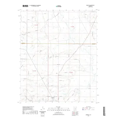
2020 Map of Warren NE
USGS Topo · Published 2020About this map
The northern edge of Warren anchors the southern boundary of this Bradley and Cleveland County landscape, where the Saline River meanders through a network of wetlands and forested bottomlands. Tributaries such as Seay Cr, Walker Cr, and Walnut Cr drain the surrounding terrain, feeding into the river system. The presence of Bradley County Lake, Scott Lake, and Fullerton Lake highlights the importance of managed and natural water bodies in this region of Arkansas.
Find a feature on this map
66 named features on this map. Tap any name to fly to it.
Don’t see what you’re looking for? This feature index may not catch every label — zoom into the map to look around manually.
Map Details
Editions of this 2020 Warren NE Map
This is the sole edition of this map. No revisions or reprints were ever made.
Other maps of this area

1935 · Feenyville
USGS Topo · 1:62,500

1953 · Greenwood
USGS Topo · 1:250,000

1953 · El Dorado
USGS Topo · 1:250,000

1956 · Greenwood
USGS Topo · 1:250,000

1957 · El Dorado
USGS Topo · 1:250,000

1958 · El Dorado
USGS Topo · 1:250,000

1960 · El Dorado
USGS Topo · 1:250,000

1970 · New Edinburg
USGS Topo · 1:24,000

1970 · Herbine
USGS Topo · 1:24,000
1972 · Wilmar South
USGS Topo · 1:24,000