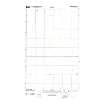
2010 Map of Warren SW
USGS Topo · Published 2010About this map
Nyskoga Cemetery sits in the northwest corner of this agricultural landscape in Polk County, Minnesota. The region is defined by a rigorous grid of section lines and gravel roads, including County Hwy-228 and County Hwy-229, which facilitate movement across the flat Red River Valley terrain. This map documents a highly managed hydrological environment, where the straight path of Judicial Ditch 75 cuts across the northern fields. Unlike more varied terrain, this area is organized entirely around large-scale farming, with infrastructure like Center St W and 140th St NW forming the essential framework for rural life and land management during this period.
Find a feature on this map
10 named features on this map. Tap any name to fly to it.
Don’t see what you’re looking for? This feature index may not catch every label — zoom into the map to look around manually.
Map Details
Editions of this 2010 Warren SW Map
This is the sole edition of this map. No revisions or reprints were ever made.
Other maps of this area

1918 · Warren
USGS Topo · 1:62,500

1934 · Grand Forks
USGS Topo · 1:24,000

1934 · Grand Forks
USGS Topo · 1:62,500

1938 · Grand Forks
USGS Topo · 1:62,500

1952 · Grand Forks
USGS Topo · 1:250,000

1952 · Thief River Falls
USGS Topo · 1:250,000

1955 · Warren
USGS Topo · 1:62,500

1956 · Thief River Falls
USGS Topo · 1:250,000

1956 · Grand Forks
USGS Topo · 1:250,000

1957 · Thief River Falls
USGS Topo · 1:250,000