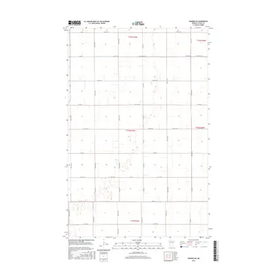
2016 Map of Warren SW
USGS Topo · Published 2016About this map
The low-lying agricultural plains of Polk County, Minnesota, are defined by a rigorous grid of section lines and drainage infrastructure. Water management is the primary landscape feature, dominated by the Judicial Ditch Number Seventyfive, also labeled as Judicial Ditch 75. This channel cuts across the northern tiers of the map, illustrating the massive scale of public works required to reclaim this prairie land for cultivation. The topography is exceptionally flat, with the road network following strict township and range lines. Key thoroughfares such as Co Hwy 23, Co Hwy 67, and Co Hwy 21 provide the backbone for rural movement, connecting isolated farmsteads across the townships of T154N, T153N, and T152N. The map reveals a highly structured landscape where natural drainage has been engineered into a rectilinear system to support the region's deep-rooted farming heritage.
Find a feature on this map
39 named features on this map. Tap any name to fly to it.
Don’t see what you’re looking for? This feature index may not catch every label — zoom into the map to look around manually.
Map Details
Editions of this 2016 Warren SW Map
This is the sole edition of this map. No revisions or reprints were ever made.
Other maps of this area

1918 · Warren
USGS Topo · 1:62,500

1934 · Grand Forks
USGS Topo · 1:24,000

1934 · Grand Forks
USGS Topo · 1:62,500

1938 · Grand Forks
USGS Topo · 1:62,500

1952 · Grand Forks
USGS Topo · 1:250,000

1952 · Thief River Falls
USGS Topo · 1:250,000

1955 · Warren
USGS Topo · 1:62,500

1956 · Thief River Falls
USGS Topo · 1:250,000

1956 · Grand Forks
USGS Topo · 1:250,000

1957 · Thief River Falls
USGS Topo · 1:250,000