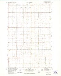
1982 Map of Warren SW
USGS Topo · Published 1982About this map
The rural township of Sandsville and its neighbors Northland, Tabor, and Sullivan define this landscape in Polk County during the early 1980s. The terrain is characterized by a precise grid of sections and an extensive artificial drainage system designed for high-latitude prairie agriculture, including Judicial Ditch No 75, County Ditch No 2, and County Ditch No 41. For genealogists and local historians, the Nyskoga Cem in the northern portion of the quadrangle serves as a significant focal point for family research in this sparsely settled region.
Find a feature on this map
12 named features on this map. Tap any name to fly to it.
Don’t see what you’re looking for? This feature index may not catch every label — zoom into the map to look around manually.
Map Details
Editions of this 1982 Warren SW Map
This is the sole edition of this map. No revisions or reprints were ever made.
Other maps of this area

1918 · Warren
USGS Topo · 1:62,500

1934 · Grand Forks
USGS Topo · 1:24,000

1934 · Grand Forks
USGS Topo · 1:62,500

1938 · Grand Forks
USGS Topo · 1:62,500

1952 · Grand Forks
USGS Topo · 1:250,000

1952 · Thief River Falls
USGS Topo · 1:250,000

1955 · Warren
USGS Topo · 1:62,500

1956 · Thief River Falls
USGS Topo · 1:250,000

1956 · Grand Forks
USGS Topo · 1:250,000

1957 · Thief River Falls
USGS Topo · 1:250,000