
1957 Map of Warren
USGS Topo · Published 1964About this map
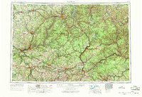
The Allegheny National Forest dominates the heart of this mid-century Pennsylvania study, reflecting a landscape defined by timber, oil, and heavy industry. At its center, the newly formed Allegheny River Reservoir appears alongside established industrial hubs like Oil City and Bradford. The rail network remains a vital skeleton across the region, featuring the Pennsylvania RR, Baltimore & Ohio RR, and the Erie RR navigating the drainages of the Clarion River and Tionesta Creek.
Find a feature on this map
78 named features on this map. Tap any name to fly to it.
Don’t see what you’re looking for? This feature index may not catch every label — zoom into the map to look around manually.
Map Details
Editions of this 1957 Warren Map
4 editions found
Other maps of this area

1898 · Olean
USGS Topo · 1:62,500

1899 · Erie
USGS Topo · 1:62,500

1900 · Erie
USGS Topo · 1:62,500

1900 · Salamanca
USGS Topo · 1:62,500

1900 · Kittanning
USGS Topo · 1:62,500

1901 · Rural Valley
USGS Topo · 1:62,500

1902 · Kittanning
USGS Topo · 1:62,500

1903 · Curwensville
USGS Topo · 1:62,500

1903 · Rural Valley
USGS Topo · 1:62,500

1903 · Houtzdale
USGS Topo · 1:62,500