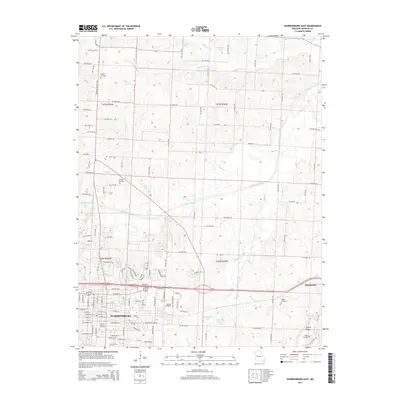
2014 Map of Warrensburg East
USGS Topo · Published 2014About this map
The Univ of Central Missouri anchor the southwestern portion of this Missouri landscape, where the expansion of Warrensburg meets the rural reaches of Johnson County. The terrain is defined by the Warrensburg Ridge and the winding course of the Blackwater River, which flows across the center of the sheet fed by numerous tributaries like Ham Br and Cottonwood Br. This 2014 survey documents the interface between the college town and the small community of Montserrat to the east.
Find a feature on this map
130 named features on this map. Tap any name to fly to it.
Don’t see what you’re looking for? This feature index may not catch every label — zoom into the map to look around manually.
Map Details
Editions of this 2014 Warrensburg East Map
This is the sole edition of this map. No revisions or reprints were ever made.
Other maps of this area

1885 · Warrensburg
USGS Topo · 1:125,000

1887 · Warrensburg
USGS Topo · 1:125,000

1894 · Warrensburg
USGS Topo · 1:125,000

1917 · Knobnoster
USGS Topo · 1:62,500

1947 · Jefferson City
USGS Topo · 1:250,000

1954 · Jefferson City
USGS Topo · 1:250,000

1954 · Centerview
USGS Topo · 1:24,000

1955 · Cornelia
USGS Topo · 1:24,000
1955 · Burtville
USGS Topo · 1:24,000

1955 · Jefferson City
USGS Topo · 1:250,000