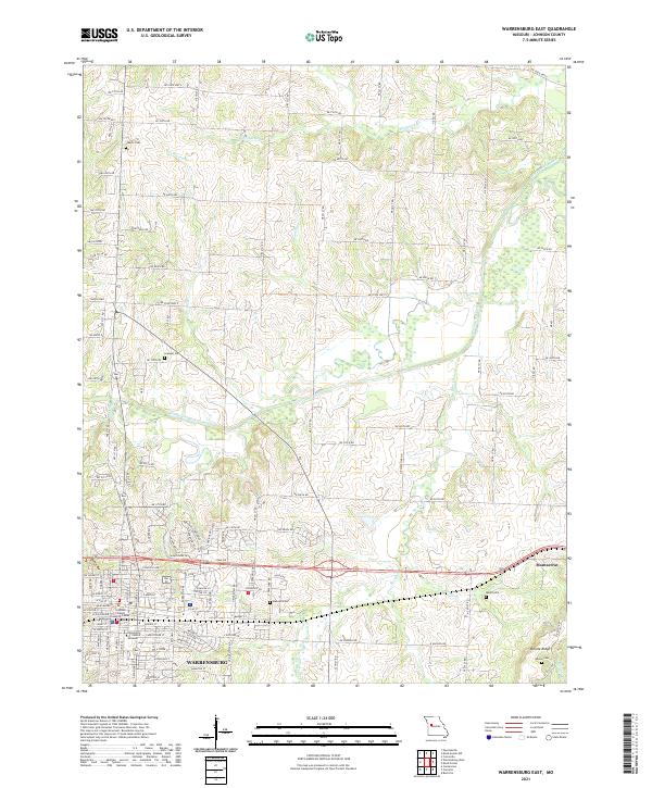
2021 Map of Warrensburg East
USGS Topo · Published 2021About this map
Warrensburg serves as a prominent focal point for this 2021 survey, showing the eastern expansion of the city and its relationship to the surrounding Johnson County agricultural landscape. The map highlights the sprawling campus of the University of Central Missouri and the Johnson County Justice Center, alongside established residential grids. Moving east toward Montserrat, the terrain is defined by a dense network of watercourses including the Blackwater River, Blackjack Cr, and Bear Cr, which carve through the undulating countryside. Genealogists will find several burial grounds preserved in the landscape, such as Liberty Cem, Granger Cem, and Adams Cem near Bristle Ridge. The map documents a modern transition where traditional rural landmarks and family cemeteries intersect with contemporary municipal growth and high-traffic corridors like Veterans Rd.
Find a feature on this map
69 named features on this map. Tap any name to fly to it.
Don’t see what you’re looking for? This feature index may not catch every label — zoom into the map to look around manually.
Map Details
Editions of this 2021 Warrensburg East Map
This is the sole edition of this map. No revisions or reprints were ever made.
Other maps of this area

1885 · Warrensburg
USGS Topo · 1:125,000

1887 · Warrensburg
USGS Topo · 1:125,000

1894 · Warrensburg
USGS Topo · 1:125,000

1917 · Knobnoster
USGS Topo · 1:62,500

1947 · Jefferson City
USGS Topo · 1:250,000

1954 · Jefferson City
USGS Topo · 1:250,000

1954 · Centerview
USGS Topo · 1:24,000

1955 · Cornelia
USGS Topo · 1:24,000
1955 · Burtville
USGS Topo · 1:24,000

1955 · Jefferson City
USGS Topo · 1:250,000