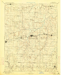
1894 Map of Warrensburg
USGS Topo · Published 1913About this map
Warrensburg stands as the central hub of this 1885 survey of Johnson County and its neighbors, showing the town's early growth around the Normal school and the Iron Spring. The landscape is defined by its transit corridors, most notably the Missouri Pacific Railroad and its Main Line, which connects significant coal and clay mining stops like Montserrat and Carbon Hill. To the west, the settlement of Holden serves as a major secondary rail junction.
Find a feature on this map
67 named features on this map. Tap any name to fly to it.
Don’t see what you’re looking for? This feature index may not catch every label — zoom into the map to look around manually.
Map Details
Editions of this 1894 Warrensburg Map
5 editions found

Other maps of this area

1885 · Warrensburg
USGS Topo · 1:125,000

1887 · Clinton
USGS Topo · 1:125,000

1887 · Harrisonville
USGS Topo · 1:125,000

1887 · Sedalia
USGS Topo · 1:125,000

1887 · Warsaw
USGS Topo · 1:125,000

1887 · Butler
USGS Topo · 1:125,000

1887 · Warrensburg
USGS Topo · 1:125,000

1889 · Lexington
USGS Topo · 1:125,000

1890 · Marshall
USGS Topo · 1:125,000

1892 · Marshall
USGS Topo · 1:125,000