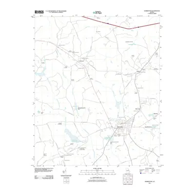
2011 Map of Warrenton
USGS Topo · Published 2011About this map
Warrenton, the seat of Warren County, serves as the primary hub of this landscape, where the local road network converges near the Warrenton Post Office. The area is characterized by a high density of burial grounds, providing significant genealogical value through sites like the Sallie Hill Cemetery, Gospel Aid Society Cemetery, and Hardaway-Fuller Cemetery. The transition between the small towns of Norwood and Camak is marked by a complex system of creeks, including Whetstone Creek and Rocky Comfort Creek, which are managed by several structural dams and reservoirs such as Reservoir 14.
Find a feature on this map
91 named features on this map. Tap any name to fly to it.
Don’t see what you’re looking for? This feature index may not catch every label — zoom into the map to look around manually.
Map Details
Editions of this 2011 Warrenton Map
This is the sole edition of this map. No revisions or reprints were ever made.
Other maps of this area

1906 · Crawfordville
USGS Topo · 1:125,000

1953 · Athens
USGS Topo · 1:250,000

1958 · Athens
USGS Topo · 1:250,000

1959 · Athens
USGS Topo · 1:250,000

1963 · Athens
USGS Topo · 1:250,000

1971 · Beall Springs
USGS Topo · 1:24,000
1972 · Wrightsboro
USGS Topo · 1:24,000
1972 · Bastonville
USGS Topo · 1:24,000
1972 · Thomson West
USGS Topo · 1:24,000

1972 · Sharon
USGS Topo · 1:24,000