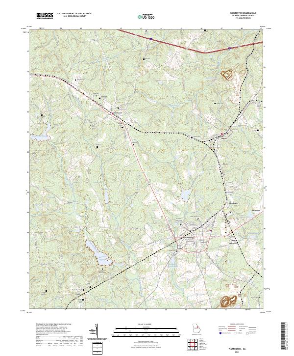
2024 Map of Warrenton
USGS Topo · Published 2024About this map
The Warren County Courthouse serves as the focal point for this landscape, anchoring the street grid of Warrenton. This quadrangle reveals a distribution of family-named cemeteries and community-focused sites that illustrate the rural settlement patterns of central Georgia. Smaller hubs like Norwood, Camak, and Norris are connected by a network of regional roads, while the surrounding terrain is defined by the drainage of Rocky Comfort Creek and Whetstone Creek.
Find a feature on this map
119 named features on this map. Tap any name to fly to it.
Don’t see what you’re looking for? This feature index may not catch every label — zoom into the map to look around manually.
Map Details
Editions of this 2024 Warrenton Map
This is the sole edition of this map. No revisions or reprints were ever made.
Other maps of this area

1906 · Crawfordville
USGS Topo · 1:125,000

1953 · Athens
USGS Topo · 1:250,000

1958 · Athens
USGS Topo · 1:250,000

1959 · Athens
USGS Topo · 1:250,000

1963 · Athens
USGS Topo · 1:250,000

1971 · Beall Springs
USGS Topo · 1:24,000
1972 · Wrightsboro
USGS Topo · 1:24,000
1972 · Bastonville
USGS Topo · 1:24,000
1972 · Thomson West
USGS Topo · 1:24,000

1972 · Sharon
USGS Topo · 1:24,000