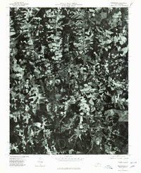
1977 Map of Warrenton
USGS Topo · Published 1979About this map
Warrenton and its surrounding rail-influenced settlements appear in sharp relief on this orthophotograph based on 1977 aerial imagery. The landscape is a distinct mosaic of agricultural clearings and dense woodland, centered on the intersection of major transit corridors in Warren County. The compact urban grid of the county seat at Warrenton contrasts with the linear development along the rail lines passing through Norlina and Ridgeway.
Find a feature on this map
5 named features on this map. Tap any name to fly to it.
Don’t see what you’re looking for? This feature index may not catch every label — zoom into the map to look around manually.
Map Details
Editions of this 1977 Warrenton Map
This is the sole edition of this map. No revisions or reprints were ever made.
Other maps of this area

1953 · Greensboro
USGS Topo · 1:250,000

1954 · Greensboro
USGS Topo · 1:250,000

1955 · Boydton
USGS Topo · 1:62,500

1962 · Greensboro
USGS Topo · 1:250,000

1966 · Greensboro
USGS Topo · 1:250,000

1968 · South Hill SE
USGS Topo · 1:24,000

1968 · Bracey
USGS Topo · 1:24,000

1968 · John H Kerr Dam
USGS Topo · 1:24,000
1970 · Macon
USGS Topo · 1:24,000

1970 · Vicksboro
USGS Topo · 1:24,000