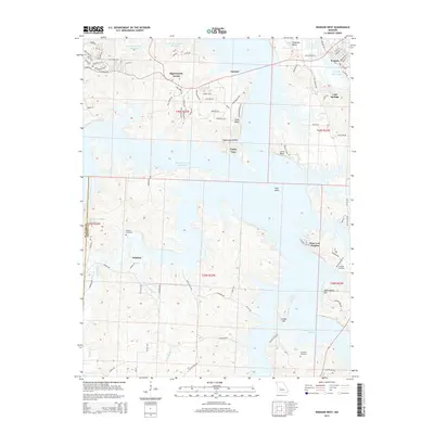
2015 Map of Warsaw West
USGS Topo · Published 2015About this map
The expansive waters of Harry S Truman Reservoir dominate this landscape, where the reservoir's fingers reach into the deep draws of Sugarcamp Hollow and along Peal Bend. The topography is defined by significant elevations such as Indian Hill and Laird Bluff, which overlook the submerged river valleys. On the eastern edge, the settlement of Warsaw serves as a gateway to both the reservoir and the Lake of the Ozarks, showing the transition between established town centers and the development of residential pockets like Pom-o-sa Heights.
Find a feature on this map
84 named features on this map. Tap any name to fly to it.
Don’t see what you’re looking for? This feature index may not catch every label — zoom into the map to look around manually.
Map Details
Editions of this 2015 Warsaw West Map
This is the sole edition of this map. No revisions or reprints were ever made.
Other maps of this area

1887 · Clinton
USGS Topo · 1:125,000

1887 · Warsaw
USGS Topo · 1:125,000

1894 · Warsaw
USGS Topo · 1:125,000

1894 · Clinton
USGS Topo · 1:125,000

1935 · Dell
USGS Topo · 1:24,000

1936 · Shawnee Bend
USGS Topo · 1:24,000

1936 · Schuyler
USGS Topo · 1:24,000

1940 · Iconium
USGS Topo · 1:24,000

1941 · Valhalla
USGS Topo · 1:24,000
1944 · Iconium
USGS Topo · 1:24,000