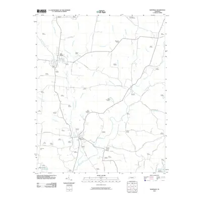
2010 Map of Wartrace
USGS Topo · Published 2010About this map
Bell Buckle and Wartrace serve as the primary hubs in this central Tennessee landscape, connected by a network of rural roads and the rail corridor passing through Bowmans Cut. The area is notably dense with family and community burial grounds, such as the Hollywood Cemetery, Bethsalem Cemetery, and the Henry-Jarman Cemetery, reflecting a long history of local settlement and genealogical depth. The terrain is defined by the winding course of Garrison Fork and its numerous tributaries, including Kelly Creek and Wartrace Creek, which carve through various hollows like Justice Hollow and Puncheon Camp Hollow. To the southeast, the geography shifts toward Bedford Lake and Morgan Lake, where the Morgan Lake Dam regulates the local hydrology. This 2010 survey illustrates a region where small-town centers remain tied to their agricultural and topographical roots, with scattered communities like Happy Valley positioned along the historical transit lines of Bedford County.
Find a feature on this map
106 named features on this map. Tap any name to fly to it.
Don’t see what you’re looking for? This feature index may not catch every label — zoom into the map to look around manually.
Map Details
Editions of this 2010 Wartrace Map
This is the sole edition of this map. No revisions or reprints were ever made.
Other maps of this area

1913 · Hollow Springs
USGS Topo · 1:62,500

1936 · Ovoca
USGS Topo · 1:24,000

1936 · Webbs Jungle
USGS Topo · 1:24,000

1936 · Shelbyville
USGS Topo · 1:24,000

1936 · Deason
USGS Topo · 1:24,000

1936 · Beech Grove
USGS Topo · 1:24,000

1936 · Noah
USGS Topo · 1:24,000

1936 · Wartrace
USGS Topo · 1:24,000

1936 · Normandy
USGS Topo · 1:24,000

1936 · Fosterville
USGS Topo · 1:24,000