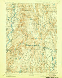
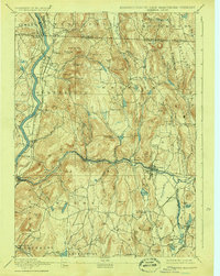
1894 Map of Warwick
USGS Topo · Published 1905About this map
The Connecticut River and Millers River valleys define the rugged landscape of this tri-state border region, where early industrial and agricultural corridors intersect. The late 19th-century transportation network is exceptionally detailed, featuring the Fitchburg Railroad following the Millers River and the New London Northern Railroad tracing the Connecticut. A northern Ashuelot Railroad spur and specialized stops like South Vernon Junction, Wendell Depot, and Gill Station illustrate the importance of rail to small-town commerce. Settlement patterns are focused around hubs like Northfield, Orange, and the elevated Warwick village near Mount Grace. Smaller hamlets like Lock Village and Northfield Farms are documented alongside numerous family-named landmarks such as Alexander Hill and Beers Mountain, reflecting a period when the river-and-rail economy supported a dense web of rural communities.
Find a feature on this map
123 named features on this map. Tap any name to fly to it.
Don’t see what you’re looking for? This feature index may not catch every label — zoom into the map to look around manually.
Map Details
Editions of this 1894 Warwick Map
6 editions found

Other maps of this area

1885 · Northampton
USGS Topo · 1:62,500

1886 · Northampton
USGS Topo · 1:62,500

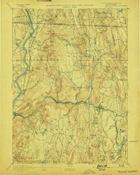
1887 · Warwick
USGS Topo · 1:62,500

1887 · Belchertown
USGS Topo · 1:62,500

1887 · Winchendon
USGS Topo · 1:62,500

1887 · Barre
USGS Topo · 1:62,500

1889 · Barre
USGS Topo · 1:62,500

1889 · Warwick
USGS Topo · 1:62,500

1890 · Belchertown
USGS Topo · 1:62,500

1890 · Greenfield
USGS Topo · 1:62,500