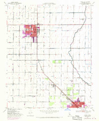
1953 Map of Wasco
USGS Topo · Published 1970About this map
Wasco and Shafter anchor this portion of the San Joaquin Valley, where a meticulous grid of agricultural roads and irrigation infrastructure dictates the landscape. The Atchison Topeka and Santa Fe railroad line cuts diagonally through the southern half of the sheet, connecting North Shafter and Myricks Corner to the regional rail network. The importance of local education and civil services is evident in the numerous campuses mapped, including Thomas Jefferson Sch, Richland Sch, and Maple Sch, along with the North Kern Hospital and a local Library.
Find a feature on this map
53 named features on this map. Tap any name to fly to it.
Don’t see what you’re looking for? This feature index may not catch every label — zoom into the map to look around manually.
Map Details
Editions of this 1953 Wasco Map
Other maps of this area

1910 · Buena Vista Lake
USGS Topo · 1:125,000

1912 · Buena Vista Lake
USGS Topo · 1:125,000

1927 · McFarland
USGS Topo · 1:31,680

1930 · McFarland
USGS Topo · 1:31,680

1930 · Leonards
USGS Topo · 1:31,680

1930 · Hamlin School
USGS Topo · 1:31,680

1930 · Wasco
USGS Topo · 1:31,680

1930 · Pond
USGS Topo · 1:31,680

1930 · Famoso
USGS Topo · 1:31,680

1930 · Rosedale
USGS Topo · 1:31,680