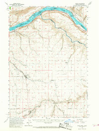
1957 Map of Wasco
USGS Topo · Published 1968About this map
The town of Wasco serves as a hub for this plateau landscape in the late 1950s, situated at the convergence of several major drainages like Spanish Hollow and Fulton Canyon. The map illustrates a transitional period for the Columbia River corridor before later hydroelectric projects further altered the shoreline, preserving details of Preachers Eddy and the Middle John Day Rapids. Along the northern border, the Spokane Portland And Seattle railroad tracks the water's edge, while the Union Pacific and Pacific Highway provide the primary southern transit through the hills.
Find a feature on this map
53 named features on this map. Tap any name to fly to it.
Don’t see what you’re looking for? This feature index may not catch every label — zoom into the map to look around manually.
Map Details
Editions of this 1957 Wasco Map
2 editions found
Other maps of this area

1916 · Arlington
USGS Topo · 1:125,000

1916 · Condon
USGS Topo · 1:125,000

1953 · The Dalles
USGS Topo · 1:250,000

1956 · The Dalles
USGS Topo · 1:250,000

1957 · The Dalles
USGS Topo · 1:250,000

1957 · Wasco
USGS Topo · 1:62,500

1957 · Goldendale
USGS Topo · 1:62,500

1957 · Wishram
USGS Topo · 1:62,500

1957 · Satus Pass
USGS Topo · 1:62,500

1962 · Erskine
USGS Topo · 1:24,000