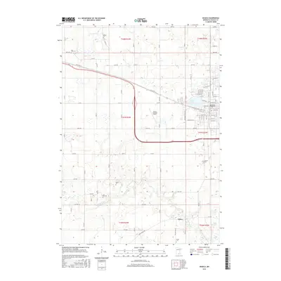
2016 Map of Waseca
USGS Topo · Published 2016About this map
The Waseca townsite serves as the primary hub of this southern Minnesota landscape, where the grid of city streets transitions into a surrounding expanse of agricultural sections and wetlands. Along the southern reaches of the map, the Le Sueur River meanders toward the small settlement of Wilton, which sits near the expansive Senn Marsh. The area is notably dense with small family and community burial grounds, including Krassin Cem, Saint Mary Cem, and Wilton Cem, providing a clear record of local genealogy and early settlement patterns. Transport and connectivity are centered on the Waseca Municipal Airport and the corridor of Old US Hwy 14, which cuts diagonally across the northern townships. Near the city center, Loon Lake provides a distinct natural landmark amidst the numerous numbered avenues and county roads that define the region's modern infrastructure.
Find a feature on this map
59 named features on this map. Tap any name to fly to it.
Don’t see what you’re looking for? This feature index may not catch every label — zoom into the map to look around manually.
Map Details
Editions of this 2016 Waseca Map
This is the sole edition of this map. No revisions or reprints were ever made.
Other maps of this area

1953 · Saint Paul
USGS Topo · 1:250,000

1954 · Mason City
USGS Topo · 1:250,000

1957 · Mason City
USGS Topo · 1:250,000

1958 · Mason City
USGS Topo · 1:250,000

1959 · Saint Paul
USGS Topo · 1:250,000

1962 · Morristown
USGS Topo · 1:24,000

1962 · Meriden
USGS Topo · 1:24,000

1966 · Waseca
USGS Topo · 1:24,000

1966 · Janesville
USGS Topo · 1:24,000

1966 · Waterville
USGS Topo · 1:24,000