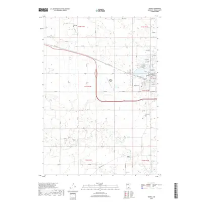
2019 Map of Waseca
USGS Topo · Published 2019About this map
The Waseca townsite serves as the primary hub of this 2019 survey, defined by its street grid and proximity to Loon Lake. The landscape is a mix of agricultural plots and wetlands, notably Senn Marsh to the southeast and the winding path of the Le Sueur River in the southern portion of the quadrangle. Outside the main settlement, the area is dotted with small rural cemeteries that offer significant value for genealogical research, including Minske Cem, Krassin Cem, and Saint Mary Cem. To the south, the community of Wilton sits near the Wilton Cemetery, while the Waseca Municipal Airport stands as a notable modern landmark. The transportation network is anchored by Old US Hwy 14 and a series of county roads, such as Co Rd 52 and Co Rd 17, which provide structure to the surrounding farmland.
Find a feature on this map
61 named features on this map. Tap any name to fly to it.
Don’t see what you’re looking for? This feature index may not catch every label — zoom into the map to look around manually.
Map Details
Editions of this 2019 Waseca Map
This is the sole edition of this map. No revisions or reprints were ever made.
Other maps of this area

1953 · Saint Paul
USGS Topo · 1:250,000

1954 · Mason City
USGS Topo · 1:250,000

1957 · Mason City
USGS Topo · 1:250,000

1958 · Mason City
USGS Topo · 1:250,000

1959 · Saint Paul
USGS Topo · 1:250,000

1962 · Morristown
USGS Topo · 1:24,000

1962 · Meriden
USGS Topo · 1:24,000

1966 · Waseca
USGS Topo · 1:24,000

1966 · Janesville
USGS Topo · 1:24,000

1966 · Waterville
USGS Topo · 1:24,000