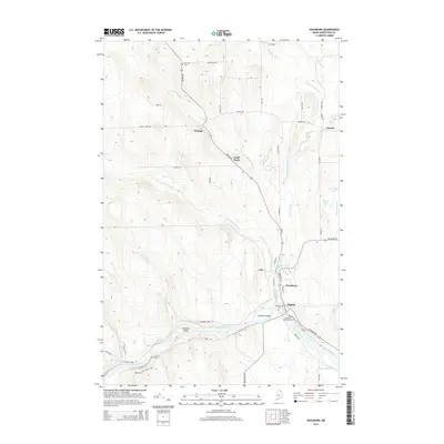
2014 Map of Washburn
USGS Topo · Published 2014About this map
The Aroostook River winds through the southern reaches of this landscape, creating notable features such as Stratton Island and Donnelly Island. The settlement of Washburn serves as a primary hub, situated near the confluence of Salmon Brook and the main river. To the north and west, smaller communities like Perham, North Wade, and Carson are linked by a network of rural roads such as Blackstone Rd and Perham Rd.
Find a feature on this map
55 named features on this map. Tap any name to fly to it.
Don’t see what you’re looking for? This feature index may not catch every label — zoom into the map to look around manually.
Map Details
Editions of this 2014 Washburn Map
This is the sole edition of this map. No revisions or reprints were ever made.
Other maps of this area

1929 · Portage
USGS Topo · 1:62,500

1929 · Caribou
USGS Topo · 1:48,000

1931 · Ashland
USGS Topo · 1:48,000

1931 · Portage
USGS Topo · 1:62,500

1932 · Caribou
USGS Topo · 1:62,500

1934 · Ashland
USGS Topo · 1:62,500

1935 · Presque Isle
USGS Topo · 1:62,500

1953 · Ashland
USGS Topo · 1:62,500

1953 · Portage
USGS Topo · 1:62,500
1953 · New Sweden
USGS Topo · 1:24,000