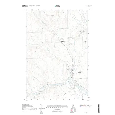
2018 Map of Washburn
USGS Topo · Published 2018About this map
The Aroostook River winds through the southern reaches of this landscape, its course marked by Donnelly Island and Stratton Island as it flows past the community of Washburn. The settlement of Washburn serves as a local hub, where a Po and Mill Pond are situated near the junction of several key roads. This 2018 survey reveals a network of agricultural and timber-related transport, with small settlements like Perham, North Wade, and Carson connected by rural routes such as Blackstone Rd and Case Rd. Numerous burial grounds, including Fairview Cem and Riverside Cem, are distributed across the township, providing essential locations for genealogical research and local history. The topography is defined by the drainage basins of Salmon Brook and its western branch, which cut through the highlands of northern Maine.
Find a feature on this map
49 named features on this map. Tap any name to fly to it.
Don’t see what you’re looking for? This feature index may not catch every label — zoom into the map to look around manually.
Map Details
Editions of this 2018 Washburn Map
This is the sole edition of this map. No revisions or reprints were ever made.
Other maps of this area

1929 · Portage
USGS Topo · 1:62,500

1929 · Caribou
USGS Topo · 1:48,000

1931 · Ashland
USGS Topo · 1:48,000

1931 · Portage
USGS Topo · 1:62,500

1932 · Caribou
USGS Topo · 1:62,500

1934 · Ashland
USGS Topo · 1:62,500

1935 · Presque Isle
USGS Topo · 1:62,500

1953 · Ashland
USGS Topo · 1:62,500

1953 · Portage
USGS Topo · 1:62,500
1953 · New Sweden
USGS Topo · 1:24,000