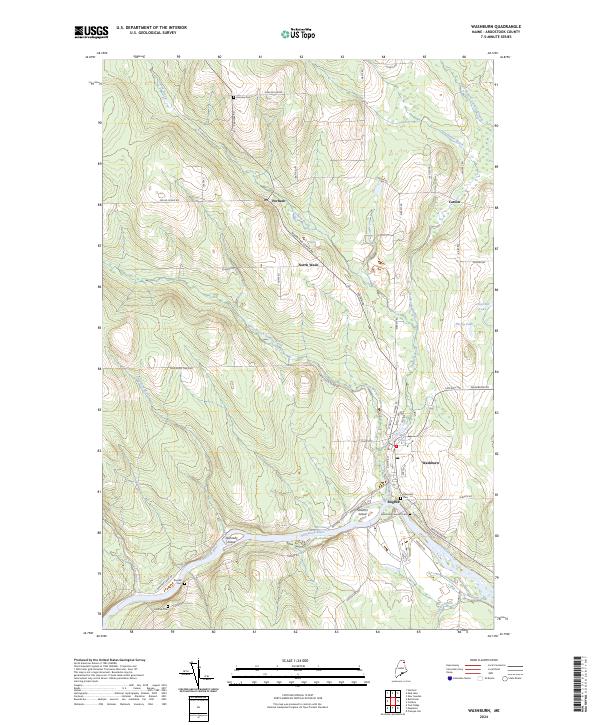
2024 Map of Washburn
USGS Topo · Published 2024About this map
The Aroostook River winds through the southern portion of this landscape, defining the geography of local agricultural and timber settlements. Central to the area is Washburn, situated near the confluence where Salmon Brook meets the river, a location historically significant for water-powered industry as evidenced by the nearby Mill Pond. The map details a network of rural townships including Perham, North Wade, and the smaller community of Bugbee. Genealogists will find considerable value in the documentation of several family and community burial grounds, such as Fairview Cem to the north and the Riverside Extension Cem near the riverbanks. The terrain is marked by distinctive features like Donnelly Island and Stratton Island, which sit within the river's main channel. This survey provides a contemporary view of these northern Maine townships, showing how modern road networks like Woodland Center Rd connect the isolated farmsteads and wooded tracts.
Find a feature on this map
52 named features on this map. Tap any name to fly to it.
Don’t see what you’re looking for? This feature index may not catch every label — zoom into the map to look around manually.
Map Details
Editions of this 2024 Washburn Map
This is the sole edition of this map. No revisions or reprints were ever made.
Other maps of this area

1929 · Portage
USGS Topo · 1:62,500

1929 · Caribou
USGS Topo · 1:48,000

1931 · Ashland
USGS Topo · 1:48,000

1931 · Portage
USGS Topo · 1:62,500

1932 · Caribou
USGS Topo · 1:62,500

1934 · Ashland
USGS Topo · 1:62,500

1935 · Presque Isle
USGS Topo · 1:62,500

1953 · Ashland
USGS Topo · 1:62,500

1953 · Portage
USGS Topo · 1:62,500
1953 · New Sweden
USGS Topo · 1:24,000