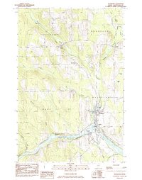
1984 Map of Washburn
USGS Topo · Published 1985About this map
The Aroostook River curves through the heart of this Northern Maine landscape, serving as the focal point for the riverside community of Washburn. At the time of this survey, the town functioned as a central hub with the WC Foster Sch and a High Sch serving the local population. The Mill Pond sits just north of the village center, where Salmon Brook meets the town’s grid. A heavy reliance on rail is evident through the path of the Bangor and Aroostook railroad, which parallels the river and connects smaller settlements like Carson and Perham.
Find a feature on this map
36 named features on this map. Tap any name to fly to it.
Don’t see what you’re looking for? This feature index may not catch every label — zoom into the map to look around manually.
Map Details
Editions of this 1984 Washburn Map
This is the sole edition of this map. No revisions or reprints were ever made.
Other maps of this area

1929 · Portage
USGS Topo · 1:62,500

1929 · Caribou
USGS Topo · 1:48,000

1931 · Ashland
USGS Topo · 1:48,000

1931 · Portage
USGS Topo · 1:62,500

1932 · Caribou
USGS Topo · 1:62,500

1934 · Ashland
USGS Topo · 1:62,500

1935 · Presque Isle
USGS Topo · 1:62,500

1953 · Ashland
USGS Topo · 1:62,500

1953 · Portage
USGS Topo · 1:62,500
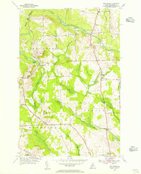
1953 · New Sweden
USGS Topo · 1:24,000