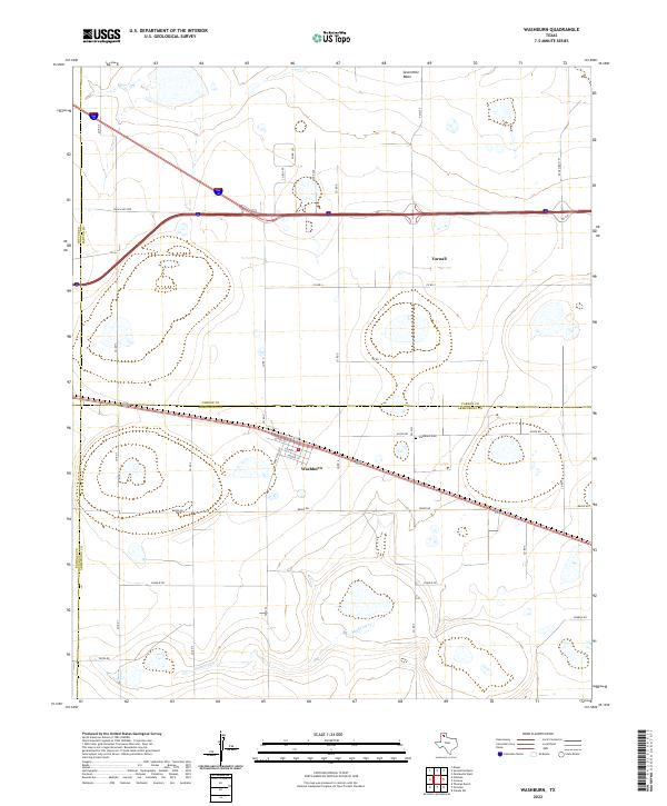
2022 Map of Washburn
USGS Topo · Published 2022About this map
Washburn sits at the intersection of local history and modern transportation in this high-plains landscape. The settlement layout is defined by a grid of named streets including Lively St, Looney St, and Moore St, positioned along the path of US Hwy 287. To the north, the small community of Yarnall marks the northern extent of the developed area, while the Washburn Cem remains a significant point of interest for genealogists tracing local families. The physical geography is dominated by the broad, flat expanses typical of the Texas Panhandle, interrupted by the natural drainage of Mulberry Cr in the south and the depression of Sevenmile Basin to the north. This survey illustrates the complex county lines where Potter, Carson, Randall, and Armstrong counties meet, showing how modern ranch roads like Ranch Rd 2250 lace together these rural jurisdictions.
Find a feature on this map
34 named features on this map. Tap any name to fly to it.
Don’t see what you’re looking for? This feature index may not catch every label — zoom into the map to look around manually.
Map Details
Editions of this 2022 Washburn Map
This is the sole edition of this map. No revisions or reprints were ever made.
Other maps of this area

1953 · Mayer
USGS Topo · 1:24,000

1953 · Sevenmile Basin
USGS Topo · 1:24,000

1954 · Amarillo
USGS Topo · 1:250,000

1956 · Washburn
USGS Topo · 1:24,000

1956 · Thomas Ranch
USGS Topo · 1:24,000

1956 · Pullman
USGS Topo · 1:24,000

1958 · Amarillo
USGS Topo · 1:250,000

1960 · Fairview
USGS Topo · 1:24,000

1960 · Claude
USGS Topo · 1:62,500

1966 · Panhandle West
USGS Topo · 1:24,000