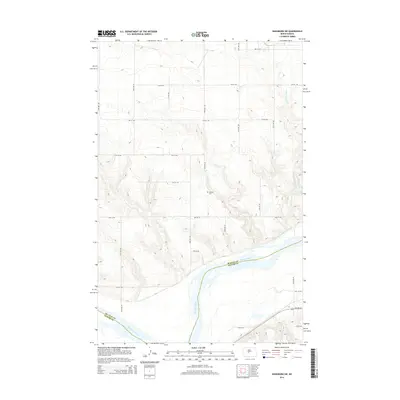
2014 Map of Washburn SW
USGS Topo · Published 2014About this map
Missouri River meanders through the southern portion of this landscape, forming the natural boundary between McLean and Oliver Counties. This 2014 survey documents a predominantly rural expanse defined by a grid of agricultural access roads including 3rd St SW and 11th St SW, which navigate the terrain north of the river valley. The upland areas are dissected by drainage features such as Coal Lake Coulee, which winds toward the river in the east. Genealogy and local history researchers will find the Conklin Cem centrally located, serving as a significant landmark in this sparsely settled region. Modern transportation is represented by ND-200-Alt which cuts across the southeastern corner, providing a link between the river valley and the surrounding plains.
Find a feature on this map
15 named features on this map. Tap any name to fly to it.
Don’t see what you’re looking for? This feature index may not catch every label — zoom into the map to look around manually.
Map Details
Editions of this 2014 Washburn SW Map
This is the sole edition of this map. No revisions or reprints were ever made.
Other maps of this area

1948 · Stanton
USGS Topo · 1:62,500

1949 · Stanton
USGS Topo · 1:62,500

1949 · Washburn
USGS Topo · 1:62,500

1954 · McClusky
USGS Topo · 1:250,000

1958 · McClusky
USGS Topo · 1:250,000

1961 · Washburn
USGS Topo · 1:24,000

1961 · Washburn NE
USGS Topo · 1:24,000

1961 · Underwood
USGS Topo · 1:24,000

1967 · Washburn SW
USGS Topo · 1:24,000

1967 · Stanton SE
USGS Topo · 1:24,000