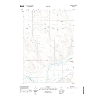
2018 Map of Washburn SW
USGS Topo · Published 2018About this map
The Missouri River cuts a wide path through the southern half of this landscape, marking the natural boundary where McLean and Oliver Counties meet. This 2018 survey reveals a terrain defined by the sweeping bends of the river and the carved drainage of Coal Lake Coulee in the northeast. The region remains predominantly rural, organized by the grid of the Public Land Survey System including portions of townships t145n r83w and t144n r83w. Local history is anchored by small, isolated landmarks such as the Birka Lutheran Cem in the northwest and the Conklin Cem near the center of the quadrangle. These sites, along with a network of county roads like Co Hwy 19 and Co Hwy 20, provide the primary points of reference across an open prairie and river-bottom environment.
Find a feature on this map
15 named features on this map. Tap any name to fly to it.
Don’t see what you’re looking for? This feature index may not catch every label — zoom into the map to look around manually.
Map Details
Editions of this 2018 Washburn SW Map
This is the sole edition of this map. No revisions or reprints were ever made.
Other maps of this area

1948 · Stanton
USGS Topo · 1:62,500

1949 · Stanton
USGS Topo · 1:62,500

1949 · Washburn
USGS Topo · 1:62,500

1954 · McClusky
USGS Topo · 1:250,000

1958 · McClusky
USGS Topo · 1:250,000

1961 · Washburn
USGS Topo · 1:24,000

1961 · Washburn NE
USGS Topo · 1:24,000

1961 · Underwood
USGS Topo · 1:24,000

1967 · Washburn SW
USGS Topo · 1:24,000

1967 · Stanton SE
USGS Topo · 1:24,000