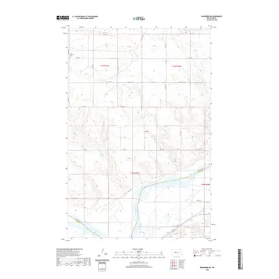
2020 Map of Washburn SW
USGS Topo · Published 2020About this map
The Missouri River flows through this southwestern portion of the Washburn area, marking a significant boundary between McLean and Oliver counties. The landscape is characterized by the dissected upland plateaus typical of central North Dakota, where coulees like Coal Lake Coulee drain toward the river valley. The region is predominantly agricultural, organized by a strict grid of section lines and county roads such as County Road 17 and McLean County 20. For those researching local heritage, the presence of Birka Lutheran Cem and Conklin Cem provides specific points of interest for family history. The map shows the Missouri River's wide, braided channel and the various islands and wetlands that define its floodplain in this reach, offering a clear view of the rural infrastructure and land management systems in place during the early 21st century.
Find a feature on this map
28 named features on this map. Tap any name to fly to it.
Don’t see what you’re looking for? This feature index may not catch every label — zoom into the map to look around manually.
Map Details
Editions of this 2020 Washburn SW Map
This is the sole edition of this map. No revisions or reprints were ever made.
Other maps of this area

1948 · Stanton
USGS Topo · 1:62,500

1949 · Stanton
USGS Topo · 1:62,500

1949 · Washburn
USGS Topo · 1:62,500

1954 · McClusky
USGS Topo · 1:250,000

1958 · McClusky
USGS Topo · 1:250,000

1961 · Washburn
USGS Topo · 1:24,000

1961 · Washburn NE
USGS Topo · 1:24,000

1961 · Underwood
USGS Topo · 1:24,000

1967 · Washburn SW
USGS Topo · 1:24,000

1967 · Stanton SE
USGS Topo · 1:24,000