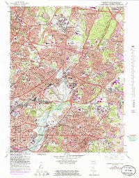
1965 Map of Washington East
USGS Topo · Published 1983About this map
The Anacostia River serves as the central artery for this mid-century landscape, where the urban density of Washington meets the expanding suburbs of Prince George's County. In the north, the sprawling campus of the University of Maryland and the residential corridors of Takoma Park and Hyattsville reflect the post-war growth of the Maryland borderlands. This 1965 survey documents a complex network of transportation and institutional land use, from the Baltimore Washington Parkway to the sprawling grounds of the National Arboretum.
Find a feature on this map
169 named features on this map. Tap any name to fly to it.
Don’t see what you’re looking for? This feature index may not catch every label — zoom into the map to look around manually.
Map Details
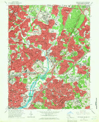
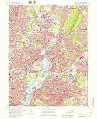
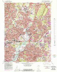
Editions of this 1965 Washington East Map
5 editions found

Other maps of this area

1890 · Mt. Vernon
USGS Topo · 1:125,000

1891 · Mt. Vernon
USGS Topo · 1:125,000

1892 · Laurel
USGS Topo · 1:62,500

1893 · Frederick
USGS Topo · 1:125,000

1894 · Laurel
USGS Topo · 1:62,500

1894 · Frederick
USGS Topo · 1:125,000

1894 · Mt. Vernon
USGS Topo · 1:125,000

1897 · Laurel
USGS Topo · 1:62,500

1897 · Mt. Vernon
USGS Topo · 1:125,000

1899 · Patuxent
USGS Topo · 1:125,000