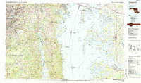
1983 Map of Washington East
USGS Topo · Published 1984About this map
The Chesapeake Bay bisects this Maryland landscape, illustrating the proximity of the bustling capital region to the rural maritime heritage of the Eastern Shore. On the western side, the suburban expansion of Prince Georges County is evident around centers like Bowie, Hyattsville, and the University of Maryland. Prominent federal installations such as Andrews Air Force Base and the Goddard Space Flight Center (NASA) occupy large tracts, while the U S Naval Academy anchors Annapolis.
Find a feature on this map
100 named features on this map. Tap any name to fly to it.
Don’t see what you’re looking for? This feature index may not catch every label — zoom into the map to look around manually.
Map Details
Editions of this 1983 Washington East Map
2 editions found
Other maps of this area

1889 · Fredericksburg
USGS Topo · 1:125,000

1890 · Mt. Vernon
USGS Topo · 1:125,000

1891 · Mt. Vernon
USGS Topo · 1:125,000

1892 · Leonardtown
USGS Topo · 1:62,500

1892 · Laurel
USGS Topo · 1:62,500

1892 · Fredericksburg
USGS Topo · 1:125,000

1892 · Drum Point
USGS Topo · 1:62,500

1892 · Prince Frederick
USGS Topo · 1:62,500

1892 · Brandywine
USGS Topo · 1:62,500

1892 · Owensville
USGS Topo · 1:62,500