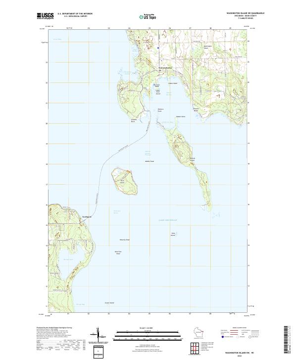
2022 Map of Washington Island SW
USGS Topo · Published 2022About this map
Detroit Harbor serves as a primary gateway on this 2022 survey, illustrating the maritime character of southwestern Washington Island. The map details the intricate relationship between the land and the surrounding waters of Lake Michigan, showing the strategic positions of Detroit Island, Plum Island, and the tiny Pilot Island within the Porte des Morts passage. These islands and their associated shoals, such as Middle Shoal and Waverly Shoal, highlight the navigational hazards that have shaped local history. On the mainland of the Door Peninsula, Northport marks the southern ferry terminus, while the inland Europe Lake and adjacent Europe Bay provide a distinct contrast to the open lake. Settlement patterns are defined by coastal roads like Detroit Harbor RD and N Port Des Morts DR, connecting isolated points such as Richters Point and Lobdells Point to the community hubs and seasonal destinations like Gislason Beach.
Find a feature on this map
64 named features on this map. Tap any name to fly to it.
Don’t see what you’re looking for? This feature index may not catch every label — zoom into the map to look around manually.
Map Details
Editions of this 2022 Washington Island SW Map
This is the sole edition of this map. No revisions or reprints were ever made.
Other maps of this area

1954 · Escanaba
USGS Topo · 1:250,000

1957 · Escanaba
USGS Topo · 1:250,000

1958 · Escanaba
USGS Topo · 1:250,000

1960 · Washington Island
USGS Topo · 1:62,500

1960 · Sister Bay
USGS Topo · 1:62,500

1960 · Ellison Bay
USGS Topo · 1:62,500

1981 · Marinette
USGS Topo · 1:100,000

1982 · Washington Island SE
USGS Topo · 1:24,000

1982 · Washington Island NW
USGS Topo · 1:24,000
1982 · Ellison Bay
USGS Topo · 1:24,000