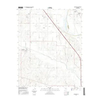
2016 Map of Washington
USGS Topo · Published 2016About this map
Noble and Washington anchor this central Oklahoma landscape divided by the sweeping course of the Canadian River. In the northern section, the town of Noble is home to the Noble Independent Order of Odd Fellows Cem, while the smaller settlement of Washington to the southwest serves as a landmark for local genealogists with the Washington Cem located nearby. The terrain is defined by a dense network of watercourses including Walnut Creek, Bell Cr, and Red Blanket Cr, which cut through the land between major transport corridors. Small-scale aviation figures prominently here, evidenced by Dick's Airport, Pacer Field, and the residential airpark community of Paradise Air Haven. This 2016 survey illustrates the persistent rural-suburban character of the region as these distinct communities maintain their separate identities along the border of Cleveland Co and McClain Co.
Find a feature on this map
61 named features on this map. Tap any name to fly to it.
Don’t see what you’re looking for? This feature index may not catch every label — zoom into the map to look around manually.
Map Details
Editions of this 2016 Washington Map
This is the sole edition of this map. No revisions or reprints were ever made.
Other maps of this area

1893 · Norman
USGS Topo · 1:62,500

1898 · Purcell
USGS Topo · 1:125,000

1898 · Pauls Valley
USGS Topo · 1:125,000

1902 · Pauls Valley
USGS Topo · 1:125,000

1902 · Rush Springs
USGS Topo · 1:125,000

1904 · Chickasha
USGS Topo · 1:125,000

1925 · Norman NO 2
USGS Topo · 1:24,000

1936 · Norman
USGS Topo · 1:62,500

1954 · Oklahoma City
USGS Topo · 1:250,000

1957 · Ardmore
USGS Topo · 1:250,000