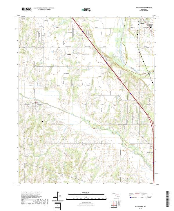
2022 Map of Washington
USGS Topo · Published 2022About this map
The Canadian River forms the natural boundary between McClain and Cleveland counties, a landscape defined by the winding paths of Walnut Creek and Red Blanket Cr. This region south of the state capital is a study in transitional development, where the established town of Washington sits near the Washington Cem, and the community of Goldsby occupies the central prairie. Small-scale aviation is a prominent feature of the terrain, with three distinct landing strips—Paradise Air Haven Airport, Dick's Airport, and Pacer Field—dotting the open lands north of the river forks. In the northeast, the outskirts of Noble are marked by the Noble Independent Order of Odd Fellows Cem, while the southern edge of the sheet reaches the northern limits of Purcell. The section-line road network, including routes like Ladd Rd and Sooner Ave, reveals the persistent grid of Oklahoma's land system.
Find a feature on this map
71 named features on this map. Tap any name to fly to it.
Don’t see what you’re looking for? This feature index may not catch every label — zoom into the map to look around manually.
Map Details
Editions of this 2022 Washington Map
This is the sole edition of this map. No revisions or reprints were ever made.
Other maps of this area

1893 · Norman
USGS Topo · 1:62,500

1898 · Purcell
USGS Topo · 1:125,000

1898 · Pauls Valley
USGS Topo · 1:125,000

1902 · Pauls Valley
USGS Topo · 1:125,000

1902 · Rush Springs
USGS Topo · 1:125,000

1904 · Chickasha
USGS Topo · 1:125,000

1925 · Norman NO 2
USGS Topo · 1:24,000

1936 · Norman
USGS Topo · 1:62,500

1954 · Oklahoma City
USGS Topo · 1:250,000

1957 · Ardmore
USGS Topo · 1:250,000