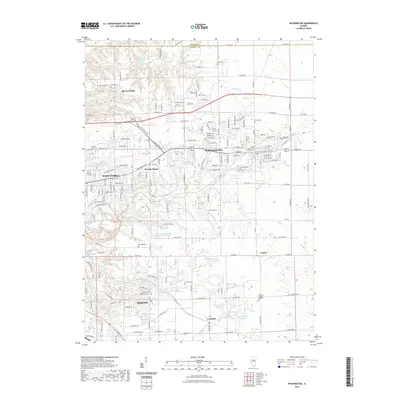
2021 Map of Washington
USGS Topo · Published 2021About this map
Washington serves as a central hub in this modern geographic profile, where the urban expansion of East Peoria and Morton meets the structured drainage of the Illinois River valley. The landscape is defined by the carved paths of Farm Creek, Tenmile Creek, and Deer Creek, alongside artificial water bodies like Bowen Lake and Kennel Lake. This area of Tazewell and Woodford Counties retains numerous markers of its community history through its burial grounds, including Union Cem, Spring Creek Cem, and Glendale Cem. Transportation remains a cornerstone of the region's character, evidenced by the prominent BNSF Railway corridor and the developed residential pockets of Beverly Manor and Harvard Hills. The presence of several ponds at the Pine Lakes Country Club illustrates the local transition from agricultural land to suburban recreation.
Find a feature on this map
175 named features on this map. Tap any name to fly to it.
Don’t see what you’re looking for? This feature index may not catch every label — zoom into the map to look around manually.
Map Details
Editions of this 2021 Washington Map
This is the sole edition of this map. No revisions or reprints were ever made.
Other maps of this area

1893 · Metamora
USGS Topo · 1:62,500

1893 · Dunlap
USGS Topo · 1:62,500

1898 · Dunlap
USGS Topo · 1:62,500

1905 · Peoria
USGS Topo · 1:62,500

1927 · Peoria
USGS Topo · 1:62,500

1928 · Mackinaw
USGS Topo · 1:62,500

1932 · Mackinaw
USGS Topo · 1:62,500

1932 · Dunlap
USGS Topo · 1:62,500

1933 · Dunlap
USGS Topo · 1:62,500

1937 · Metamora
USGS Topo · 1:62,500