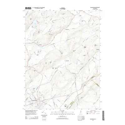
2014 Map of Washington
USGS Topo · Published 2014About this map
Washington serves as the primary urban center in this 2014 survey of northwestern New Jersey, where the Norfolk Southern rail line cuts through the southern landscape. The map reveals a dense network of ridges and valleys typical of the region, including Jenny Jump Mtn, Baldpate Mtn, and Oxford Mtn. These geological formations define the corridors of local travel and settlement, such as Jackson Valley and Pequest Valley.
Find a feature on this map
144 named features on this map. Tap any name to fly to it.
Don’t see what you’re looking for? This feature index may not catch every label — zoom into the map to look around manually.
Map Details
Editions of this 2014 Washington Map
This is the sole edition of this map. No revisions or reprints were ever made.
Other maps of this area

1888 · Hackettstown
USGS Topo · 1:62,500

1890 · Easton
USGS Topo · 1:62,500

1890 · High Bridge
USGS Topo · 1:62,500

1891 · Easton
USGS Topo · 1:62,500

1891 · Delaware Water Gap
USGS Topo · 1:62,500

1893 · Delaware Water Gap
USGS Topo · 1:62,500

1894 · Hackettstown
USGS Topo · 1:62,500

1898 · Hackettstown
USGS Topo · 1:62,500

1898 · High Bridge
USGS Topo · 1:62,500

1900 · Raritan
USGS Topo · 1:125,000
Featured Places
- Washington, NJ
- Oxford Township, NJ
- Hope Township, NJ
- Port Murray, Mansfield Township
- Washington Township, NJ