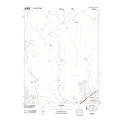
2011 Map of Washington
USGS Topo · Published 2011About this map
The growing community of Washington occupies the southeastern corner of this landscape, where residential development meets the dramatic geology of the Virgin River basin. The town's local history is anchored by the Washington City Cemetery and the Washington Post Office, situated near the major arterial corridors. To the west, the terrain rises sharply toward Middleton Black Ridge and Lava Ridge, reflecting the volcanic and sedimentary history of the region.
Find a feature on this map
27 named features on this map. Tap any name to fly to it.
Don’t see what you’re looking for? This feature index may not catch every label — zoom into the map to look around manually.
Map Details
Editions of this 2011 Washington Map
This is the sole edition of this map. No revisions or reprints were ever made.
Other maps of this area

1885 · St. George
USGS Topo · 1:250,000

1891 · St. George
USGS Topo · 1:250,000

1953 · Cedar City
USGS Topo · 1:250,000

1954 · La Verkin 3 NW
USGS Topo · 1:24,000

1954 · La Verkin 3 SW
USGS Topo · 1:24,000

1954 · St. George
USGS Topo · 1:62,500

1954 · Hurricane
USGS Topo · 1:62,500
1956 · St. George SE
USGS Topo · 1:24,000

1956 · St. George NW
USGS Topo · 1:24,000

1956 · St. George NE
USGS Topo · 1:24,000