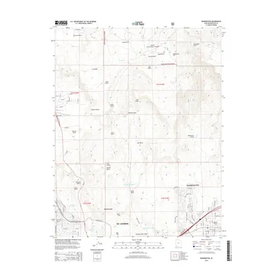
2014 Map of Washington
USGS Topo · Published 2014About this map
Saint George and the neighboring city of Washington sit at a transitional landscape where the urban grid meets the red rock canyons of southern Utah. This 2014 survey captures the rapid modern expansion of these communities, with residential developments like Edge Estates and L'Aubin pressing against the edges of the Mojave Desert. To the north, the terrain rises into the Dixie National Forest, featuring the distinct volcanic geology of Lava Ridge and the high sanctuary of Diamond Valley. The map details the vital water management systems necessary for this arid environment, from the Black Knolls Reservoir and Santa Clara Reservoir to natural sources like West Saint George Spring and Curly Spring. Local history is anchored by the Washington City Cem, while the rugged geography is defined by prominent landmarks such as Twin Peaks and the Red Hills.
Find a feature on this map
95 named features on this map. Tap any name to fly to it.
Don’t see what you’re looking for? This feature index may not catch every label — zoom into the map to look around manually.
Map Details
Editions of this 2014 Washington Map
This is the sole edition of this map. No revisions or reprints were ever made.
Other maps of this area

1885 · St. George
USGS Topo · 1:250,000

1891 · St. George
USGS Topo · 1:250,000

1953 · Cedar City
USGS Topo · 1:250,000

1954 · La Verkin 3 NW
USGS Topo · 1:24,000

1954 · La Verkin 3 SW
USGS Topo · 1:24,000

1954 · St. George
USGS Topo · 1:62,500

1954 · Hurricane
USGS Topo · 1:62,500
1956 · St. George SE
USGS Topo · 1:24,000

1956 · St. George NW
USGS Topo · 1:24,000

1956 · St. George NE
USGS Topo · 1:24,000