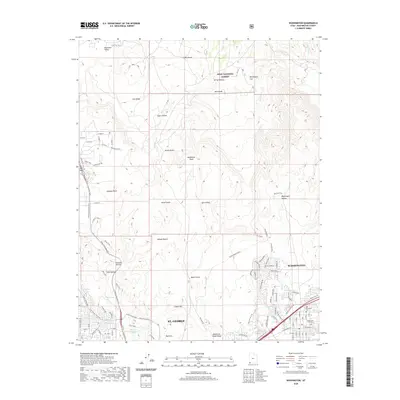
2020 Map of Washington
USGS Topo · Published 2020About this map
St. George and Washington sit at the southern edge of this landscape, where urban development meets the striking geologic formations of the Mojave Desert. The map reveals a transition from city grids to a terrain defined by ancient volcanic activity and erosion, featuring prominent landmarks like Lava Ridge, Middleton Black Ridge, and the Yellow Knolls. To the north, the protected lands of Dixie National Forest rise above Washington Flat and Spring Hollow. Local history is anchored by the Washington City Cem and Old Alexander Cem, while the modern outdoor culture of the region is evident in the Snow Canyon Bike Trail and various recreational parkways. Water sources such as Miller Spring and West Saint George Spring provide vital points of interest in this arid environment.
Find a feature on this map
52 named features on this map. Tap any name to fly to it.
Don’t see what you’re looking for? This feature index may not catch every label — zoom into the map to look around manually.
Map Details
Editions of this 2020 Washington Map
This is the sole edition of this map. No revisions or reprints were ever made.
Other maps of this area

1885 · St. George
USGS Topo · 1:250,000

1891 · St. George
USGS Topo · 1:250,000

1953 · Cedar City
USGS Topo · 1:250,000

1954 · La Verkin 3 NW
USGS Topo · 1:24,000

1954 · La Verkin 3 SW
USGS Topo · 1:24,000

1954 · St. George
USGS Topo · 1:62,500

1954 · Hurricane
USGS Topo · 1:62,500
1956 · St. George SE
USGS Topo · 1:24,000

1956 · St. George NW
USGS Topo · 1:24,000

1956 · St. George NE
USGS Topo · 1:24,000