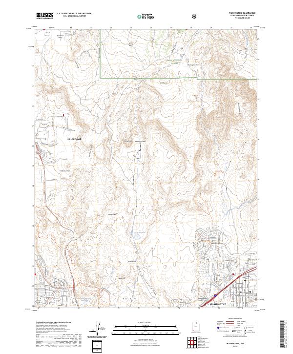
2023 Map of Washington
USGS Topo · Published 2023About this map
Washington and St. George anchor this modern survey of the Utah landscape, where suburban growth meets the protected boundaries of the Dixie National Forest and Cottonwood Canyon Wilderness. The geography is defined by prominent basaltic and sandstone formations, including the Middleton Black Ridge and the Red Hills, while water resources like the Black Knolls Reservoir and West Saint George Spring highlight the essential infrastructure of this arid region. Traces of early settlement remain visible at the Old Alexander Cem near the historic core of Washington. The map also documents an extensive network of recreational trails, such as the Snow Canyon Bike Trl and Gila Trl, which navigate the complex terrain around Buckskin Hollow and the Mojave Desert fringe.
Find a feature on this map
108 named features on this map. Tap any name to fly to it.
Don’t see what you’re looking for? This feature index may not catch every label — zoom into the map to look around manually.
Map Details
Editions of this 2023 Washington Map
This is the sole edition of this map. No revisions or reprints were ever made.
Other maps of this area

1885 · St. George
USGS Topo · 1:250,000

1891 · St. George
USGS Topo · 1:250,000

1953 · Cedar City
USGS Topo · 1:250,000

1954 · La Verkin 3 NW
USGS Topo · 1:24,000

1954 · La Verkin 3 SW
USGS Topo · 1:24,000

1954 · St. George
USGS Topo · 1:62,500

1954 · Hurricane
USGS Topo · 1:62,500
1956 · St. George SE
USGS Topo · 1:24,000

1956 · St. George NW
USGS Topo · 1:24,000

1956 · St. George NE
USGS Topo · 1:24,000