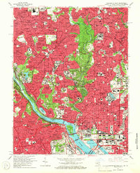
1965 Map of Washington West
USGS Topo · Published 1966About this map
Arlington National Cemetery and the monumental core of the capital dominate this mid-1960s revision, showing the city's complex interface of government, education, and historic neighborhoods. The landscape is defined by the Potomac River and the winding course of Rock Creek, which separates the dense urban blocks of Mt Pleasant and Columbia Heights from the wooded estates of Cleveland Park. The map documents a concentration of major institutions during a period of significant growth, including the National Institutes of Health and Naval Medical Center in Bethesda.
Find a feature on this map
178 named features on this map. Tap any name to fly to it.
Don’t see what you’re looking for? This feature index may not catch every label — zoom into the map to look around manually.
Map Details
Editions of this 1965 Washington West Map
4 editions found
Other maps of this area

1890 · Mt. Vernon
USGS Topo · 1:125,000

1891 · Mt. Vernon
USGS Topo · 1:125,000

1892 · Laurel
USGS Topo · 1:62,500

1893 · Frederick
USGS Topo · 1:125,000

1894 · Laurel
USGS Topo · 1:62,500

1894 · Frederick
USGS Topo · 1:125,000

1894 · Mt. Vernon
USGS Topo · 1:125,000

1897 · Laurel
USGS Topo · 1:62,500

1897 · Mt. Vernon
USGS Topo · 1:125,000

1899 · Patuxent
USGS Topo · 1:125,000