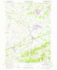
1969 Map of Washingtonville
USGS Topo · Published 1978About this map
Chillisquaque Creek and its various branches, including the West Branch and East Branch, define the rural character of this Central Pennsylvania landscape. The borough of Washingtonville sits at a central crossroads, where a corporate boundary separates the town from the agricultural surroundings of Derry and Limestone townships. Local education and community life are anchored by the DeLong Memorial Sch and several country churches like St James Ch and Trinity Ch.
Find a feature on this map
52 named features on this map. Tap any name to fly to it.
Don’t see what you’re looking for? This feature index may not catch every label — zoom into the map to look around manually.
Map Details
Editions of this 1969 Washingtonville Map
4 editions found
Other maps of this area

1892 · Shamokin
USGS Topo · 1:62,500

1893 · Sunbury
USGS Topo · 1:62,500

1893 · Shamokin
USGS Topo · 1:62,500

1924 · Milton
USGS Topo · 1:62,500

1935 · Hughesville
USGS Topo · 1:62,500

1943 · Shamokin
USGS Topo · 1:62,500

1943 · Sunbury
USGS Topo · 1:62,500

1950 · Harrisburg
USGS Topo · 1:250,000

1952 · Shamokin
USGS Topo · 1:62,500

1953 · Hughesville
USGS Topo · 1:62,500
Featured Places
- Washingtonville, PA
- Lewis Township, PA
- Turbot Township, PA
- Schuyler, Lewis Township
- Limestoneville, Limestone Township