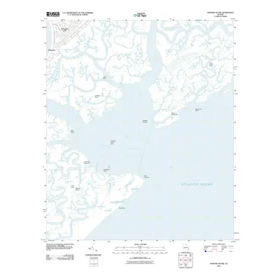
2011 Map of Wassaw Sound
USGS Topo · Published 2011About this map
Wilmington and Wilmington Park sit at the edge of a complex coastal network where the Wilmington River meets the tides of the Atlantic Ocean. This 2011 survey reveals an intricate world of barrier islands and marshland channels, notably the large expanse of Wassaw Island and the smaller Little Tybee Island to the east. The terrain is defined by hammocks and spits, such as Dead Man Hammock and Cabbage Island Spit, which negotiate the space between the salt marshes and the open sea. Numerous interior ponds like Flag Pond, Teal Pond, and Otter Pond dot the southern reaches of the marsh, showing the natural drainage patterns of this protected coastal environment. Waterways like the Bull River, Lazaretto Creek, and Shad River carve through the landscape, creating a labyrinth of tidal guts and cuts that have historically dictated navigation and settlement patterns along the Georgia coast.
Find a feature on this map
43 named features on this map. Tap any name to fly to it.
Don’t see what you’re looking for? This feature index may not catch every label — zoom into the map to look around manually.
Map Details
Editions of this 2011 Wassaw Sound Map
This is the sole edition of this map. No revisions or reprints were ever made.
Other maps of this area

1920 · Wassaw Sound
USGS Topo · 1:62,500

1920 · Bluffton
USGS Topo · 1:62,500

1942 · Savannah
USGS Topo · 1:62,500

1944 · Ossabaw Island
USGS Topo · 1:62,500

1945 · Bluffton
USGS Topo · 1:62,500

1945 · Ossabaw Island
USGS Topo · 1:62,500

1945 · Wassaw Sound
USGS Topo · 1:62,500

1946 · Brunswick
USGS Topo · 1:250,000

1947 · Savannah
USGS Topo · 1:250,000

1948 · Brunswick
USGS Topo · 1:250,000